One afternoon on our trip, we had no plans. Nowhere we had to be at a specific time. No dinner reservations. Nodda. So we grabbed a paper map, hopped into the car & started driving. We headed into Limerick, even though everyone told us not to. We headed west, stopping off at every sign marking castle ruins. We stopped in Foynes, which was thisclose to becoming PanAm’s European hub. We saw the dramatic coastline from a church parking lot. B became obsessed with going to Tralee, even though he had no idea what was there. We drove with no destination & it was glorious.
Limerick: King John’s Castle & St. Mary’s Cathedral
More than one person told us not to go to Limerick: It’s dirty. It’s commercial. It’s the Baltimore of Ireland (no offense to Baltimore). But our Ireland travel agent guru told us: “Limerick is not awesome. But King John’s Castle is!” So with that notion & the lowest expectations possible, we started our journey in Limerick. We parked in the first parking garage we could find, which turned out to be about as far from King John’s Castle as you could get, but stayed put because walking in the city is easier than left hand side of the road driving in the city. We stopped by the tourist information center & grabbed a map & some advice. The funny thing about walking in cities is that one person’s “it’s too far to walk” is another person’s “I walk less than that every morning to get to work.”
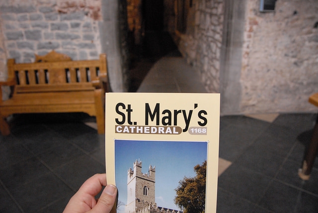
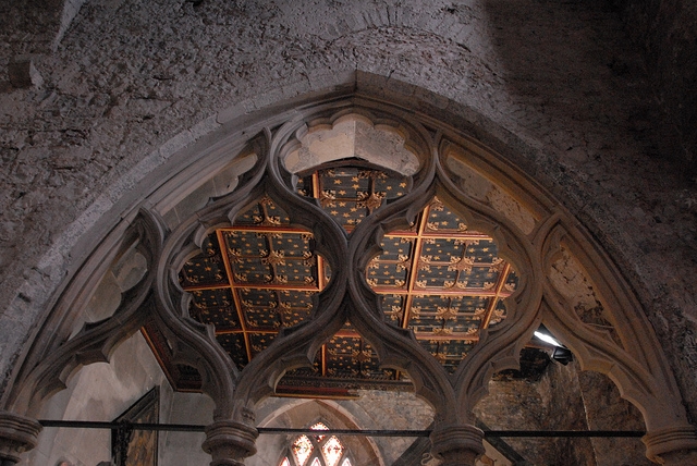
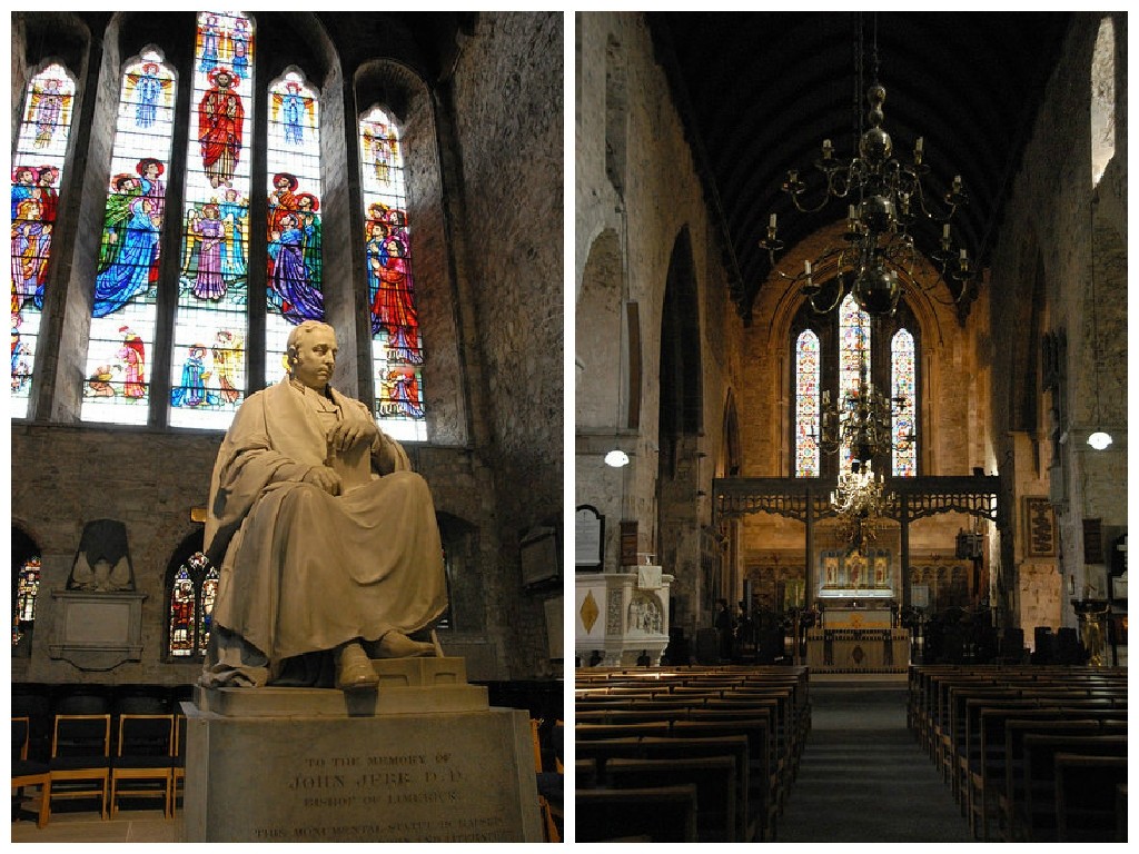
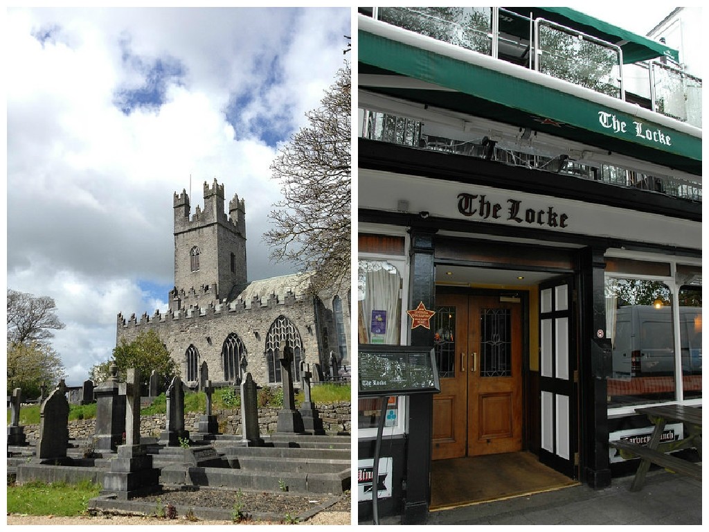
Our first stop was at St. Mary’s Cathedral. One thing we were surprised about, throughout Ireland, was an admission charge to visit a church. I don’t think I’ve ever seen this in the U.S., but given the choice between making a €3 donation to a church & paying for admission at a well-funded tourist site, I guess I’m okay with it. This gorgeous Anglican cathedral was founded in 1168 & is the oldest building in Limerick still in daily use. As an American, whose country is barely over 200 years old, this just blows my mind!
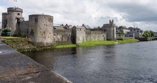
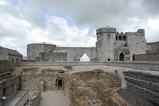
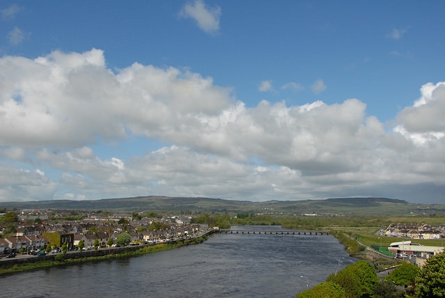
Our second stop in Limerick was King John’s Castle. Situated right along the River Shannon, the castle was built starting in the early 1200s & played an important part in the defense of Ireland. Give yourself plenty of time to visit, as the visitor education center is very impressive. By the time we were done, we finally understood the (rather tumultuous) history of Ireland. The Norman castle is still undergoing restoration, but has plenty of areas to explore & a lovely view of the river from its turrets.
Before heading west from Limerick, we at The Locke Bar for lunch. Liam, our falconry guide that morning, is from Limerick & recommended Locke Bar, which is awesome because we love to eat where the locals eat. Right across from the cathedral, we had a great meal of shepherd’s pie & Guinness. The restaurant was full of businessmen, bankers & very few tourists – the best kind of place.
Foynes & the Flying Boat
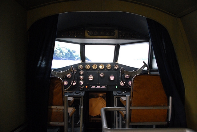
About a week before our trip, I was doing some research online & randomly came across the Foynes Flying Boat Museum. Turns out, it’s also the birthplace of Irish Coffee. But we didn’t have plans to be in Foynes, so I chalked it up to a missed opportunity & moved along. Imagine my joy as we were zipping along the N69 & saw the sign for Foynes! Since I’m kind of obsessed with planes & coffee, we had no choice but to stop & check it out.
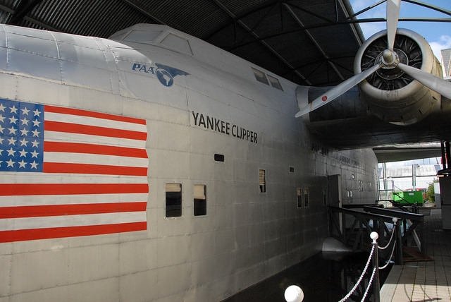
PanAm targeted the small town’s strategic location on the River Shannon as the perfect place to land their B314 (a plane Boeing designed just for them & became Boeing’s first commercial Atlantic aircraft) & usher in an era of transatlantic passenger air travel. The Flying Boat Museum tells the whole story of thriving air traffic in Foynes from 1939 to 1945. Eventually, the large international airport in Shannon was built & transatlantic aircraft had wheels, rather than rudders, & Foynes went back to being a sleepy little town. While you’re at the museum, you can stop at the cafe for an Irish Coffee, made from the original recipe in the airport where it was invented.
(C) Christina Saull – All Rights Reserved
Carrigafoyle Castle
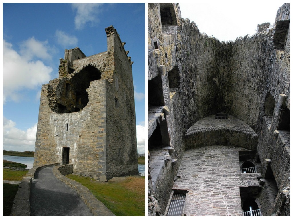
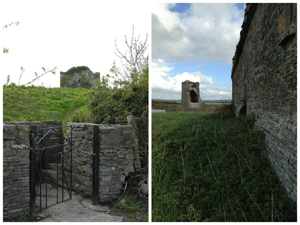
Carrigafoyle Castle was a red star on our map, located down a nonexistant winding road. When I asked B if we should stop, he gave the only acceptable answer: “Why the heck not?” As we rumbled down the one lane road, the castle suddenly came into view.
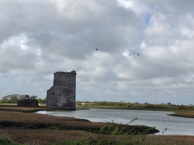
Built on the edge of an estuary in the 1490’s, the castle saw major action in 1580 when a garrison of Irish & Spanish soldiers were holding the castle for the rebel Earl of Desmond. The castle fell after three days in a siege by Sir William Pelham & the Earl’s valuables were sent to Queen Elizabeth. The castle now stands in ruins, but in remarkably good condition. You can climb up the rather wide spiral staircase onto one of the balconys to look out over the marshland.
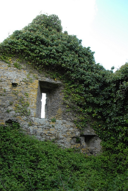
Across the street from the castle was another small building in ruins, accessible by trekking through some tall grass. With no signage or identifying information, the mind is left to wander of what it once was…
Moral of the story? Always stop at the red star on the map.
Ballybunion
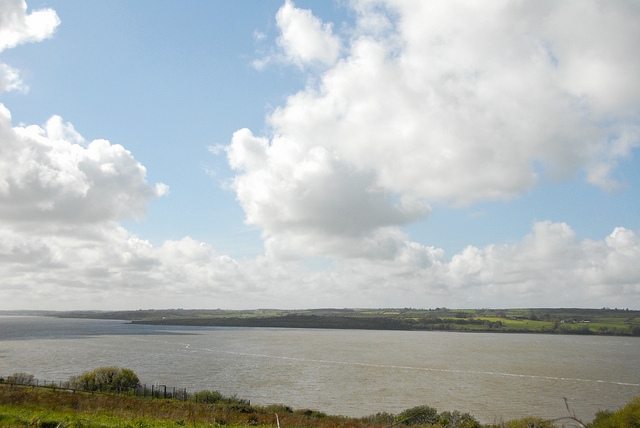
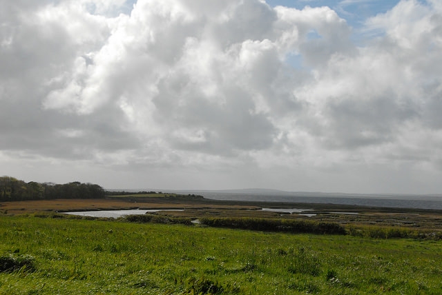
When we first set out on our little journey, we set our goal destination as Ballybunion. We had no idea what was there, but it was the furthest west we could go & that seemed good enough to us. As we drove along, we knew we were close to the coast, but couldn’t see it. Just outside of Ballybunion, we pulled into a church parking lot to study the map. For some reason, I jumped out of the car to peer over a wall, just to see if I could figure out where we were. This is what I saw:
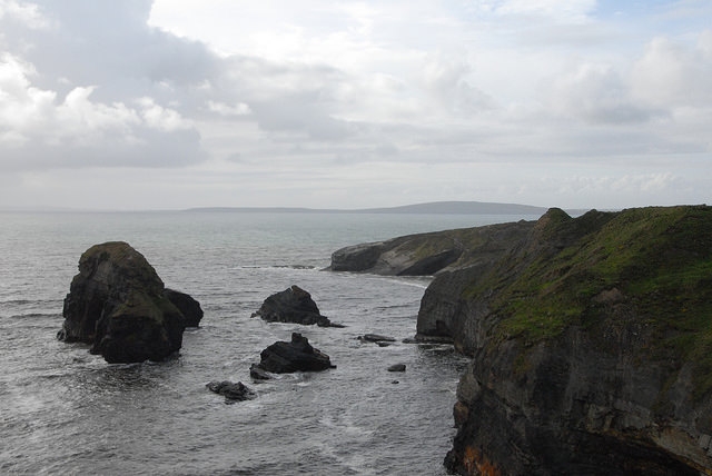
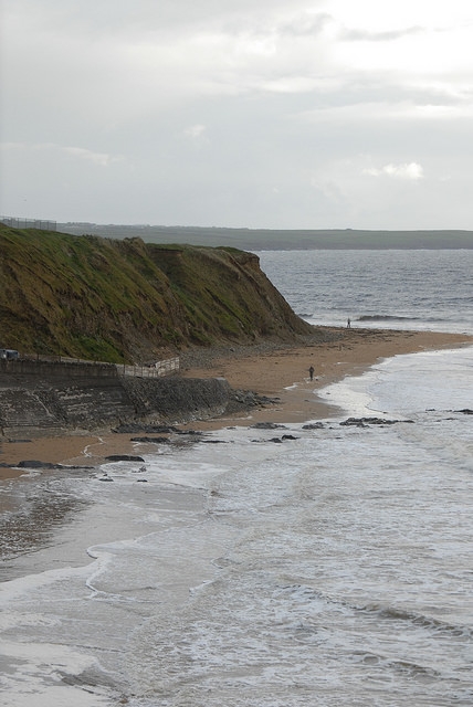
I guess we were on the coast! We drove into town & down a random side street. We parallel parked (so hard in the left hand driving car!) & B told me to get out to see if it was worth getting out for. I trotted down a little hill, turned a corner & saw this magnificent cliff lined beach stretched before me:
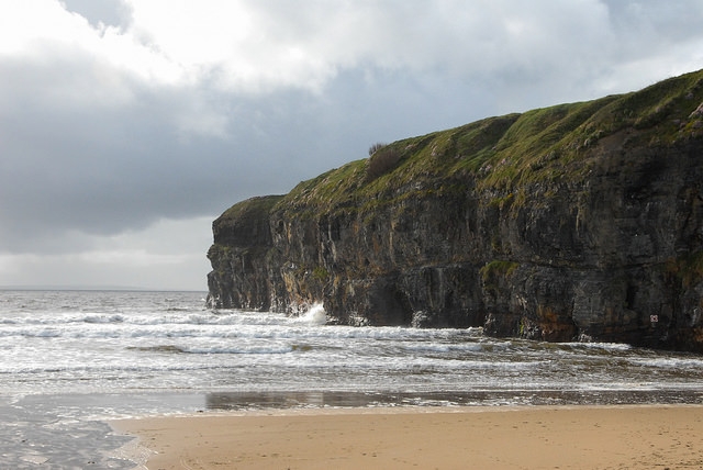
Boom! Two for two in awesome coastal views! I made B lug down my tripod & we went off exploring. Ballybunion North Beach is popular in the summer, but on this cool, drizzly evening we had the place to ourselves.
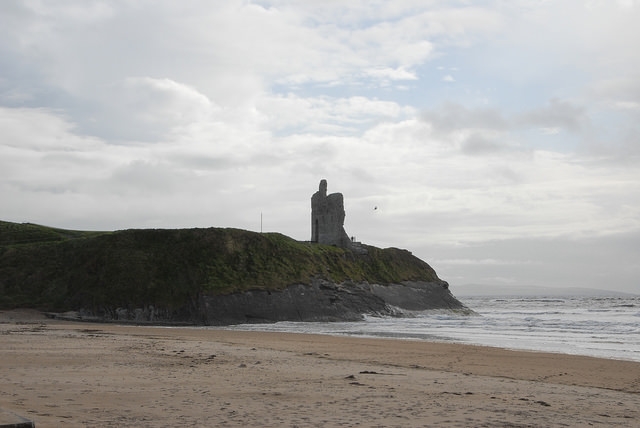
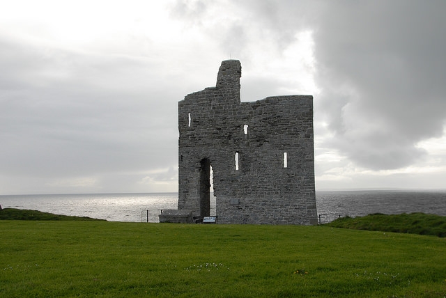
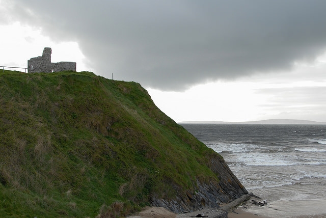
Majestically perched on a cliff, overlooking the beach, is a single wall – all that remains of the ruined Ballybunion Castle. There’s a cliff walk which takes you along several beaches, but we were losing daylight & the sky was threatening to open up at any minute, so we added that to the list for the next trip.
Tralee
After our beach trip to Ballybunion, I was ready to head back to Adare. It would take over an hour to get back & it was getting dark & starting to rain. We hadn’t yet driven in the dark & it wasn’t something I wanted to tempt fate with. But as we were studying the map, B noticed the town of Tralee. “I want to go to Traleeeeeeee,” he jokingly whined in the car. It was completely irrational: he had no idea what was in Tralee or, truly, how far away it was. We were both hungry & didn’t know if there would be a restaurant open there. But, in the end, he was the driver, so he won out. “It’ll be a pretty drive along the coast,” he promised me.
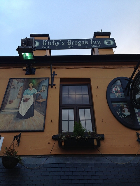
Well, it wasn’t a pretty drive along the coast, but a pretty boring drive past green fields. Almost an hour later, we arrived in sleepy Tralee, desperate for food at nearly 8pm. Kirby’s Brogue Inn declared themselves the “best restaurant in Tralee,” so in we went. We had a decent dinner of not very Irish food (I had a steak sandwich, B had a roast turkey dinner that looked straight out of an American Thanksgiving dinner), but it was nice to get out of the car & have something warm to eat.
Despite the fact that we drove back to Adare in the dark & pouring rain, it turns out that having no plans & no destination is incredibly rewarding: this was easily our favorite day of the trip.
Have you ever just gotten in the car & driven? When you travel do you navigate by GPS or good ol’ paper map? Leave me a note in the comments!
Leave a Reply